
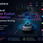



Autonomous vehicles rely on more than one type of sensor to understand what is happening around them. Cameras capture visual details, LiDAR measures depth and distance, radar detects objects and movement, and other sensors provide information about the vehicle’s position and motion. Individually, these sensors offer valuable data. However, combining their outputs can give autonomous driving systems a more complete and reliable view of the environment.
This is where sensor fusion annotation becomes essential. By accurately labeling and aligning data from multiple sensors, developers can create high-quality training datasets that help artificial intelligence (AI) systems interpret complex road environments. For companies working on data annotation for Autonomous Vehicle applications, sensor fusion annotation is an important part of building robust perception models.
What Is Sensor Fusion Annotation?
Sensor fusion refers to the process of combining information collected from different sensors to create a unified representation of the surrounding environment. Sensor fusion annotation adds structured labels to this combined data so that machine learning models can learn how objects and road elements appear across different sensor modalities.
For example, a pedestrian may appear as a visual shape in a camera frame, a cluster of points in a LiDAR point cloud, and a radar reflection. Annotators need to ensure that these representations refer to the same real-world object and assign consistent labels across the datasets.
This process can involve 2D bounding boxes, 3D cuboids, semantic segmentation, object tracking, keypoints, lane markings, road boundaries, and other annotation types. The objective is to create synchronized and consistent ground-truth data for training autonomous driving perception systems.
Why Sensor Fusion Matters in Autonomous Driving
Road environments are unpredictable. A camera can provide rich color and texture information but may struggle in darkness, glare, or adverse weather. LiDAR provides accurate depth information but does not capture visual details in the same way as cameras. Radar can perform effectively in rain, fog, and other challenging conditions while also providing valuable information about object velocity.
Sensor fusion helps compensate for these individual limitations.
When properly annotated, multimodal datasets enable AI models to learn relationships between different sensor outputs. A vehicle can use visual information to recognize a traffic sign, LiDAR data to estimate its position, and radar data to understand movement around it.
High-quality sensor fusion annotation therefore supports more reliable perception, object detection, localization, tracking, and decision-making.
Key Components of Sensor Fusion Annotation
1. Camera-LiDAR Annotation
Camera-LiDAR annotation connects 2D visual information with 3D spatial information. Annotators identify objects in camera images and associate them with corresponding points or 3D structures in LiDAR data.
This relationship helps models understand both what an object is and where it is located. Accurate calibration and alignment are critical because even small discrepancies between camera and LiDAR coordinates can introduce errors into the training dataset.
2. LiDAR-Radar Annotation
LiDAR and radar provide complementary information. LiDAR offers detailed spatial structure, while radar can provide useful velocity and distance measurements.
Annotating corresponding objects across both modalities allows machine learning systems to learn from their complementary strengths. This can be particularly valuable for detecting and tracking vehicles, cyclists, pedestrians, and other dynamic road users.
3. Cross-Modal Object Tracking
Objects move continuously through a scene. Sensor fusion annotation must therefore maintain object identity across consecutive frames and different sensor streams.
For example, a vehicle detected in one camera frame should correspond to the same vehicle in the associated LiDAR and radar data. Consistent tracking labels help models learn object motion, trajectory, and behavior over time.
4. Semantic and Instance Segmentation
Sensor fusion annotation can also classify road environments at a detailed level. Semantic segmentation may identify road surfaces, sidewalks, vegetation, buildings, vehicles, pedestrians, and lane markings.
Instance segmentation goes further by distinguishing individual objects within the same category. Combining these labels across sensor modalities provides a richer representation of complex driving scenes.
Challenges in Sensor Fusion Annotation
Creating multimodal datasets is more complex than annotating individual images or point clouds. One major challenge is sensor synchronization. Different sensors may capture data at slightly different times, making object positions appear inconsistent.
Coordinate transformation is another important issue. Camera, LiDAR, and radar sensors operate in different coordinate systems. Accurate calibration is required to map their observations correctly.
Occlusion also creates difficulties. An object may be clearly visible to one sensor but partially or completely hidden from another. Annotators must follow precise guidelines when establishing correspondences between modalities.
Finally, annotation consistency is essential. Large datasets may involve multiple annotators, making quality assurance, clear labeling instructions, and validation processes necessary to maintain reliable ground truth.
Best Practices for High-Quality Sensor Fusion Annotation
Organizations developing data annotation for Autonomous Vehicle systems should establish standardized annotation workflows before production begins.
First, sensor calibration and synchronization should be verified. Accurate timestamps and coordinate transformations provide the foundation for reliable multimodal annotation.
Second, annotation guidelines should clearly define object categories, occlusion rules, tracking requirements, and cross-sensor relationships. This reduces ambiguity and improves consistency.
Third, quality assurance should be integrated throughout the workflow. Automated checks can identify missing labels or coordinate inconsistencies, while human reviewers can verify difficult or ambiguous cases.
It is also important to include diverse driving conditions. Training data should cover different weather conditions, lighting environments, road types, traffic densities, and geographic settings. A diverse dataset helps models generalize beyond controlled scenarios.
How Sensor Fusion Annotation Improves Autonomous Vehicle AI
The ultimate value of sensor fusion annotation is better machine learning performance. When AI models receive accurately aligned and consistently labeled multimodal data, they can develop a more comprehensive understanding of their surroundings.
This can improve object detection at different distances, enhance tracking accuracy, strengthen depth estimation, and support perception in challenging environments. Better annotated data can also help reduce false detections and improve the reliability of downstream autonomous driving functions.
As autonomous vehicles become more sophisticated, perception systems will increasingly depend on the combined intelligence of multiple sensors rather than relying on a single data source.
Conclusion
Sensor fusion annotation plays a critical role in transforming raw multimodal sensor data into useful training datasets for autonomous driving AI. By connecting information from cameras, LiDAR, radar, and other sensors, annotation teams can help machine learning models understand objects, distances, movements, and road conditions more accurately.
For organizations investing in data annotation for Autonomous Vehicle technologies, a strong sensor fusion annotation strategy can provide the high-quality ground truth required to develop dependable perception systems. With accurate calibration, consistent labeling, rigorous quality control, and diverse datasets, sensor fusion annotation can help move autonomous driving systems toward safer and more capable real-world performance.